
Dastardly Plot
Returning to more interesting matters...
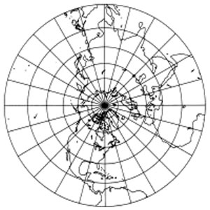
Creating an Arrakeen texture for Celestia as faithful as possible to the map given at the beginning of Dune will require translating something like this
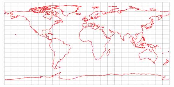
into something like the following.

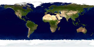
Or, more accurately, into something like this:
This will involve measuring the coordinates of a massive number of points on the original map and converting them into points on the texture. A real PITA, in other words.
I've decided that the quickest, most efficient way to achieve this will be to write another single-purpose utility app. This one will take as input parameters the size of the map image, x and y coordinates of the map center point and point to be converted, map distance to a given line of latitude (probably 60 degrees N, in this case) and the size of the destination texture. It will output the x and y coords of the point on the texture.
Creating the texture will still take a considerable amount of time, but less than trying to do it by hand!
(Note: Since no map of the southern latitudes is provided and only limited information given in the books, I will leave the southern hemisphere essentially untouched.)
Creating an Arrakeen texture for Celestia as faithful as possible to the map given at the beginning of Dune will require translating something like this

into something like the following.
Or, more accurately, into something like this:

This will involve measuring the coordinates of a massive number of points on the original map and converting them into points on the texture. A real PITA, in other words.
I've decided that the quickest, most efficient way to achieve this will be to write another single-purpose utility app. This one will take as input parameters the size of the map image, x and y coordinates of the map center point and point to be converted, map distance to a given line of latitude (probably 60 degrees N, in this case) and the size of the destination texture. It will output the x and y coords of the point on the texture.
Creating the texture will still take a considerable amount of time, but less than trying to do it by hand!
(Note: Since no map of the southern latitudes is provided and only limited information given in the books, I will leave the southern hemisphere essentially untouched.)
posted by SandChigger | 9:39 PM
![]()

6 Comments:
Hello!
I know Your Problems with the Map of Arrakis. In the German Books there are Maps of the north and south of arrakis. based on this i created a arrakis map by myself. You can find it at the dunepedia ( http://dunepedia.net / http://dunepedia.net/?pid=03b1).
Hello, Arne.
I'm familiar with your map and wondered where the features for the Southern Hemisphere came from. Do you have a link to a scan of the maps in the German edition? Is there some indication of who drew the one for the southern latitudes? The map in Dune was done by Dorothy de Fontaine, who appears to have been a cartographer of some fame.
One problem I have, though, is that I couldn't find any references in the books for some of the map details. (At least not for those I searched for.)
Finally, how did you go about creating your map? In the same way as I have described my plans for creating a texture image?
Hello!
Here is a Scan from the german books:
http://temp.upputter.de/arrakis_north.jpg
http://temp.upputter.de/arrakis_south.jpg
I couldn't find out the author.
I drew my Arrakis Map with Fireworks by streching and sqeezing the shapes of the map into the right size and form. There was no math just "feeling" when creating it :)
I hope the Images can help you.
Thanks for the scans, Arne. The map for the north has obviously been redrawn and the one for the south added. Could you tell me who the German publisher is, and the year of publication? Maybe they could eventually be contacted for details. (Not asking that you do so, of course!)
Thanks for the info on how you created your map. I still plan to go the more arduous route of a mathematical plot. (Born perfectionist = masochist, I'm afraid. ... Though I seldom live up to my own ideals!)
It is:
Das Haus Atreides - Der Wüstenplanet Die frühen Chroniken 1; 2001; Pub: Wolfgang Jeschke @ Wilhelm Heyne Verlag GmbH & Co. KG, Munich
( http://heyne.de )
Danke schön, Arne!
Post a Comment
<< Home